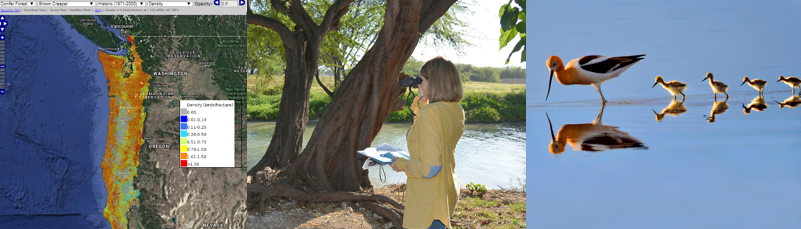

The following are some examples of the tools and resources in the AKN that industry/developers might use to answer some common questions:
I am assisting with a development project, and as part of the development process, we need to do NEPA, or conduct an analysis of potential impacts to migratory birds.
[showhide type=”post1″ more_text=”See what tools and resources might help you do this…” less_text=”Collapse tools…”]
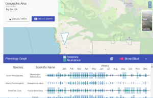
AKN Phenology Tool – The Phenology tool allows the user to view abundance and relative probability of presence summaries throughout the year for birds in a particular region or project area. For a short web tutorial on this tool, please visit the Phenology Tool video tutorial.
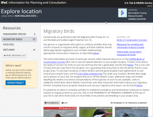
Information for Planning and Conservation System (IPaC) – The IPaC tool allows users to view their project or activity’s potential impacts on U.S. Fish & Wildlife Service’s Trust Resources, including endangered and threatened species and migratory bird species of concern. Migratory bird lists in IPaC and associated seasonal probability of presence graphs are generated using best available data on known bird occurrence via data points in the AKN. For a short web tutorial on this tool, please visit the IPaC Tool video tutorial.
Also view the Recommendations for Incorporating Migratory Bird Considerations into Environmental Reviews on the Federal Avian Data Center site (currently in development).
[/showhide]
I am building a wind facility and want to see where my facilities could be having the greatest impact on birds, and birds of conservation concern in particular, so that I can try to avoid or reduce my impact to birds in those areas.
[showhide type=”post2″ more_text=”See what tools and resources might help you do this…” less_text=”Collapse tools…”]
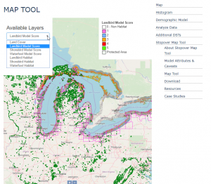
Great Lakes Stopover Map Tool – This tool maps potential stopover habitats across the region based on available GIS data layers. The maps were created by identifying attributes associated with stopover sites that could be mapped with regionally (US and Canada) available data layers, developing criteria to score these attributes, and then producing maps based on these scores to indicate the relative importance of stopover sites in our study area.
Information for Planning and Conservation System (IPaC) – The IPaC tool allows users to view their project or activity’s potential impacts on U.S. Fish & Wildlife Service’s Trust Resources, including endangered and threatened species and migratory bird species of concern. Migratory bird lists in IPaC and associated seasonal probability of presence graphs are generated using best available data on known bird occurrence via data points in the AKN. For a short web tutorial on this tool, please visit the IPaC Tool video tutorial.
AKN Phenology Tool – The Phenology tool allows the user to view abundance and relative probability of presence summaries throughout the year for birds in a particular region or project area. For a short web tutorial on this tool, please visit the Phenology Tool video tutorial.
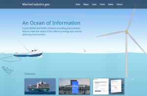
MarineCadastre.gov – MarineCadastre.gov is an integrated marine information system that provides data, tools, and technical support for ocean and Great Lakes planning. MarineCadastre.gov was designed specifically to support renewable energy siting on the U.S. Outer Continental Shelf but also is being used for other ocean-related efforts.
[/showhide]