Use this site map to view and navigate directly to the unique products and features offered throughout the AKN and its individual nodes.
AKN Core Resources
Although each node offers its own unique products, tools and resources depending on the specific geographic area and needs it was designed to address, the AKN system offers some core resources and tools that may be of benefit and interest to any AKN user. [showhide type=”post9″ more_text=”View the AKN Core Resources List…” less_text=”Collapse the AKN Core Resources List…”]
Interactive Data Summary and Analysis Tools (Using Real-time Data)
Rapid Avian Information Locator (RAIL) Tool – The RAIL tool allows the user to query a specific geographic location and return a list of birds that are known to occur in that area based on the underlying data in the AKN, along with a wealth of information about those birds including their conservation status and population size at various scales. The tool imports information from the Partners in Flight (PIF) Avian Conservation Assessment Database (ACAD) and the PIF Population Estimates Database, and also incorporates other supplemental information (e.g. conservation status on multiple scales, clutch size, bird weight, size and diet, primary habitat, photos and range maps) that might be helpful for permitting and making conservation and management decisions for birds.
Observations Map – The Observations Map allows the user to visualize, query, and investigate data at surveyed locations. It also allows users to identify which data sets are available for further inquiry and analyses. For a short web tutorial on this tool, please visit the Observations Map Tool video tutorial.
Phenology Tool – The Phenology tool allows the user to view abundance and relative probability of presence summaries throughout the year for birds in a particular region or project area. For a short web tutorial on this tool, please visit the Phenology Tool video tutorial.
Data Discovery and Download Tools
Data Catalog – The AKN publishes a Data Catalog that may be searched without an AKN account. The Catalog provides summary information about all of the datasets that are currently curated in AKN systems (with the exception of E-bird and Breeding Birds Survey).
Data Downloader – The AKN offers this application specifically for downloading observations that the owners of data in the AKN have made publicly available (AKN Data Sharing Level 5). The downloads provided through the Data Downloader are meant to be used in cross project comparisons and studies.
Data Entry Tools
Upload, Enter and Manage Data in the AKN – There are a number of options for getting your data into AKN (including bulk uploading, entering the data manually, or connecting an existing database via API). There are also a number of options for managing it after entry or upload. Visit this page for information and instructions on how to enter and manage your data in the AKN.
[/showhide]
AKN Node Resources
Avian Knowledge Network Northwest (AKNW)
[showhide type=”post2″ more_text=”View the AKNW Resources List…” less_text=”Collapse the AKNW Resources List…”]
Static Data Products
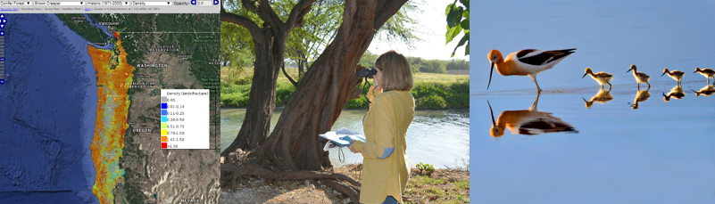
Avian Vulnerability to Climate Change Maps – Projects climate-driven changes in the abundances and distributions of 31 focal bird species in Oregon and Washington using the latest down-scaled climate projections and corresponding vegetation model outputs.
Pacific Northwest Climate Change Avian Vulnerability Tool – Developed by the North Pacific Landscape Conservation Cooperative, to inform your management about the effects of climate change on bird species found in western Washington, Oregon and California. You can use this tool to (1) view spatially explicit projections of climate change impacts to 26 bird species, (2) explore regions of high conservation priority, (3) analyze changes in bird habitat and bird communities, (4) identify new monitoring locations which can improve our understanding of climate change impacts, and (5) download our model results to use in your own analyses.
Oak Bird Pop: An Online Interactive Supplement to the Land Manager’s Guide to Bird Habitat and Populations in Oak Ecosystems of the Pacific Northwest – An interactive tool to inform land managers and others in the Pacific Northwest in the planning and implementation of oak habitat management and restoration actions. The goal is to help assess the projected population response of 31 oak-associated bird species to oak habitat changes. OakBirdPop serves as an interactive supplement to the Land Manager’s Guide to Bird Habitat and Populations in Oak Ecosystems of the Pacific Northwest.
Aquatic Bird Sites – In an effort to help coordinate aquatic bird monitoring and facilitate regionally based studies, Klamath Bird Observatory has compiled and posted descriptions for Important Aquatic Bird Sites within eastern Oregon, western Oregon, and northwestern California. The site descriptions include information such as water level fluctuations, land ownership, access issues, visibility constraints, and aquatic birds expected to be present.
Interactive Data Summary and Analysis Tools (Using Real-time Data)
AKNW Data Exploration Map – This mapping tool allows you to explore Avian Knowledge Northwest datasets. It also allows specific queries based on a set of overlays (e.g., county, watershed).
Plans and Guidance
Conservation Plans for the Pacific Northwest
- Partners in Flight (PIF) Plans for OR and WA – Oregon/Washington Partners in Flight has prepared five bird conservation plans containing strategies for the long-term maintenance of healthy bird populations in Oregon and Washington.
- PIF Plans for CA – The California Partners in Flight program has completed eight habitat and bioregion Bird Conservation Plans (BCP’s) for the State. The habitat BCPs include Riparian, Oak Woodlands, Coastal Scrub and Chaparral, Grasslands, Coniferous Forests, Sagebrush, and Desert. there is also a Sierra Nevada Bioregion BCP.
Resource Management Guides for the Pacific Northwest
- Informing Ecosystem Management: Science and Process for Landbird Conservation in the Western United States
- Prairie, Oaks, and People—A Conservation Business Plan to Revitalize the Prairie-Oak Habitats of the Pacific Northwest
- Land Manager’s Guide to Bird Habitat and Populations in Oak Ecosystems of the Pacific Northwest
- Restoring Oak Habitats in Southern Oregon & Northern California
- Resources for Managed Forests – Includes a suite of resources that present specific conservation actions that can be implemented as part of forest management operations. Such actions can enhance important bird habitat attributes.
- Conservation Assessments for Forest Service Region 6 Sensitive Species and Oregon/Washington Bureau of Land Management Interagency Special Status Sensitive Species (ISSSSP) Program – Read the Conservation Assessments, Species Fact Sheets, and more for the Oregon and Washington ISSSP bird species.
Science Summaries (Case Studies and Conservation Measures Guidance)
- Oak, Woodlands, and Chaparral – Informs management decisions regarding how different fuel-reduction methods (i.e., mechanical or manual treatments) influence bird communities and how the size and arrangement of the remaining chaparral patches influences whether shrub-associated birds will use them.
- Bird Monitoring as an Aid to Riparian Restoration – Provides an overview of the Trinity River Restoration Program, summarizes bird monitoring findings (2002-2011), and provides information for land managers with respect to bird-habitat associations and riparian restoration.
- Riparian Fuel Treatments – Addresses an information gap regarding decisions to include riparian areas in fuel reduction efforts.
- Bird Monitoring as an Aid to Meadow Restoration – Based on a meadow restoration project implemented on the Rogue River-Siskiyou National Forest and describes how bird monitoring can produce findings that will inform future restoration and contribute to the ecosystem conservation vision outlined by conservation policies in United States.
- Birds in Mixed-Conifer Hardwood Forests – Shows that management for certain habitat attributes that is informed by bird conservation plans and results from related research and monitoring efforts can benefit Partners in Flight focal species and many other species and elements of biodiversity in these forests.
- Handbook of Field Methods for Monitoring Landbirds – A compilation of methods that can be used to assay population size, demographics, and status of many species of birds occurring in a wide variety of habitats. The handbook will prove useful to field biologists, managers, and scientists anywhere in the New World from the arctic through the tropics.
- NPS Bird Monitoring Protocols by Klamath Bird Observatory – Landbird field monitoring protocols developed by Klamath Bird Observatory for the National Park Service Inventory and Monitoring Klamath Network. Protocols include: Areas Search, Point Count, Vegetation, Mist Netting, and Checklist.
Short-eared Owl Citizen Science Program – The Western Asio Flammeus Landscape Study (WAfLS) is a citizen science project designed to gather information to better evaluate the population status of this species. Such information is needed by conservation practitioners who want to design management actions that will reverse the Short-eared Owl population declines.
E-bird Northwest – AKNW has developed this regional portal of Cornell Laboratory of Ornithology’s international eBird program. eBird Northwest is meant to serve as the primary citizen science application of AKNW, providing content and services to bird‐watching and natural resource management audiences throughout the Pacific Northwest. AKNW supports the Pacific Northwest Citizen Science platform of eBird Northwest, promoting regional news and information to the citizen science community. [/showhide]
Borderlands Avian Data Center (BADC)
[showhide type=”post3″ more_text=”View the BADC Resources List…” less_text=”Collapse the BADC Resources List…”]
Static Data Products
Borderlands Avian Data Center Planning for Landscape Management and Adaptation Tool (PLuMA) – Birds are closely linked to climate and vegetation. Because of this, they can provide early warnings of broader changes to come. PLuMA is an interactive, online tool that allows users to: (1) identify climate change impacts; (2) focus on conservation and adaptation priorities; (3) highlight priority locations for monitoring, habitat restoration, and protection; (4) determine priority species for monitoring; (5) build capacity for collaboration across institutions and borders. Use this tool to visualize the projected impacts of a changing climate on birds and habitats across northern Mexico and the southwestern United States.
Interactive Data Summary and Analysis Tools (Using Real-time Data)
Borderlands Avian Data Center Observations Map – Allows the user to query, visualize, and investigate bird observation data at surveyed locations in a map interface. It also allows users to identify which data sets are publicly available for further inquiry and analyses. Available map overlays include Bird Conservation Regions, Important Bird Areas, Joint Venture regions, Ramsar sites, congressional districts, watersheds, and more.
[/showhide]
California Avian Data Center (CADC)
[showhide type=”post4″ more_text=”View the CADC Resources List…” less_text=”Collapse the CADC Resources List…”]
Static Data Products
Future San Francisco Bay Tidal Marshes – A Climate-Smart Planning Tool – The tool can be used to (1) view and query maps to understand how sea level rise may change the extent of tidal marsh habitat and bird species distribution over the next 100 years; (2) make informed decisions about adaptation planning, restoration potential, and land acquisition given various sea-level rise and sedimentation scenarios; and (3) identify areas both vulnerable and resilient to future sea-level rise.
Modeling Bird Distribution Responses to Climate Change – This tool networks climate models and multi-source bird data to predict current and future species distributions for California terrestrial breeding bird species. There are nearly 200 species available for viewing. These species represent 7 major habitat types found within California including riparian, oak woodland, scrub, conifer, grassland, wetlands, and desert habitat types.
Predicted Bird Species Distribution in Central Valley (LIP)(2008) – The development of sophisticated species distribution modeling techniques provides an opportunity to greatly improve the value of species occurrence data. Using statistical and machine learning approaches, point occurrence data can be related to GIS-based environmental data layers to generate robust, spatially continuous predictions of species occurrence. The approach was to use a machine learning algorithm called Maxent to predict species distributions for a variety of species in California’s Central Valley.
The Sierra Nevada Avian Information Network (2010) – The Sierra Nevada Avian Monitoring Information project aims to conduct distribution population monitoring of four management indicator species (MIS) in order to track changes in their distributions at the Sierra Nevada scale by monitoring the changes in their occurrence across a number of sample locations.
Farallon Marine Bird and Mammal Distribution – This is an “atlas of maps”, for selected bird and mammal species, giving you a picture of our PRBO’s data collected during ocean surveys by boat. It’s a way of locating where birds and mammals are concentrating on and around the Farallon Islands, to help us understand the most important feeding areas for these animals. This atlas of maps is meant to be a resource for policy advisors, scientists, stakeholders, and the public interested in learning how marine birds and mammals concentrate on and around the Farallones.
Atlas of Colonies of Inland-Breeding Seabirds in California (2004) – This project was designed to document the current status and highlight the conservation needs in California of a group of seven species of colonial or semicolonial waterbirds: American White Pelican, Double-crested Cormorant, Ring-billed Gull, California Gull, Caspian Tern, Forster’s Tern, and Black Tern
Interactive Data Summary and Analysis Tools (Using Real-time Data)
Map-Based Avian Data Summaries – These are interactive maps showing all CalPIF collaborators’ study areas contributed to date and detailed information for each focal species, with live updates. One of the main goals of the California Partners In Flight (CalPIF) Bird Conservation Plan endeavor is to document the health and status of bird populations across the entire state. To this end, PRBO has developed a database of CalPIF bird monitoring sites and served as a repository for species breeding status information for the entire state.
The Western Hummingbird Information Network (2010) – The Western Hummingbird Information Network (WHIN) is the home website of the WHP and is the clearinghouse for all information relative to hummingbirds and hummingbird conservation.
[/showhide]
Federal Avian Data Center (FADC)
[showhide type=”post1″ more_text=”View the FADC Resources List…” less_text=”Collapse the FADC Resources List…”]
Plans, Guidance and Other Information
Conservation Measures – Access beneficial practices that can be applied to help conserve birds and avoid and minimize impacts on birds from certain activities.
Environmental Review Guidance – This guidance, currently under development, will provide information on how to incorporate considerations for the conservation and protection of migratory birds into existing environmental review processes, such as National Environmental Policy Act (NEPA). It may also apply to other types of review processes relevant to land management plans and project development outside the scope of NEPA. It will identify sources for best practices, available data and tools, best management practices, and laws and requirements relevant to the protection of migratory birds and their habitats.
Decision Support Tool Directory for Federal Agencies – This page centralizes a number of tools and resources both inside and outside the AKN that can be used by Federal agencies and others to learn more about patterns, trends and statuses of birds across the U.S., territories, and some coastal areas and bordering countries.
[/showhide]
Eastern Avian Data Center (EADC)
[showhide type=”post5″ more_text=”View the EADC Resources List…” less_text=”Collapse the EADC Resources List…”]
Maps and Histograms – The EDAC Histogram tools show the temporal distribution of a given species or set of species over the course of a year. The map tools provide a way to visualize, query, and investigate data at surveyed locations. Tools and maps are divided into northeast and southeast regions.
[/showhide]
Integrated Waterbird Management and Monitoring Network (IWMM)
[showhide type=”post6″ more_text=”View the IWMM Resources List…” less_text=”Collapse the IWMM Resources List…”]
Interactive Summary and Analysis Tool (Using Real-Time Data)
IWMM offers a number of options to look at summaries and analysis of IWMM data. All reports may be viewed interactively, or downloaded and saved in PDF or CSV format. However, you must be must be a registered user and log-in to the IWMM Portal to be able to access these options. Instructions on how to become a registered user and gain access to these reporting tools can be found on the IWMM Protocols and Data Management page. The following is a description of each summary/analysis option:
Bird Survey – Includes 1) a summary of visits with total number of birds counted, total number of taxa observed, and a diversity index, 2) a summary of bird observations with total for each species counted, relative frequency, average and max counts, birds counted per hour and per hectare, and 3) a pivot table for bird observations that provides total species counts by survey unit and date.
Unit Condition – Shows summary statistics of site conditions generated for each survey unit and includes minimum/maximum, median, mean, and standard deviation values. Summarized parameters include gauge height, water depth, land cover, vegetation height, and salinity.
Bird Use Days – Estimates total amount of bird use filtered by location, species, date, and protocol and can be further grouped by survey unit and guild. The BUD reports allow for adjustment by survey area (BUD per hectare) and can also incorporate legacy data. Migration Curves for individual survey units can also be plotted for up to five species simultaneously.
Vegetation Survey – Reports are based on annual surveys conducted at individual survey units within a project site. Summary tables report all plant taxa present, coverage levels, dominance status, and a species diversity index for the unit. The Seed Production Index (SPI) report tracks temporal changes in production for several types of seed-producing plants important to foraging waterfowl.
[/showhide]
Midwest Avian Data Center (MWADC)
[showhide type=”post7″ more_text=”View the MWADC Resources List…” less_text=”Collapse the MWADC Resources List…”]
Static Data Products
Demographic Model Tool – Beginning in 2010, the Midwest Demographic Monitoring Working Group partnered with the Institute for Bird Populations (IBP) to assess the regional value of existing bird demographic data from the MAPS program within the Midwest. This project was completed in 2011, and resulted in the creation of several useful products: 1) baseline demographic parameter estimates (including survivorship and productivity), 2) maps of protected lands indexed by their potential to provide source habitat, 3) GIS tool (below) allowing managers to analyze landscapes and extract specific spatial statistics for input to models, and 4) species management guidelines for creating or maintaining source habitat.
Great Lakes Migratory Bird Stopover Map Tool – Maps potential stopover habitats across the region based on available GIS data layers. The maps were created by identifying attributes associated with stopover sites that could be mapped with regionally (US and Canada) available data layers, developing criteria to score these attributes, and then producing maps based on these scores to indicate the relative importance of stopover sites in our study area.
[/showhide]
Rocky Mountain Avian Data Center (RMADC)
[showhide type=”post8″ more_text=”View the RMADC Resources List…” less_text=”Collapse the RMADC Resources List…”]
Interactive Summary and Analysis Tool (Using Real-Time Data)
RMADC Data Exploration and Analysis Interface – This tool draws from underlying Rocky Mountain Bird Observatory (RMBO) data to allow the user to view a map where they can query and visualize species detections by species type, multiple spatial and temporal extents, study design type, and several other parameters. Users can also add different base layers to view with those detections (BCRs, National Park Service lands, BLM Fields Offices, DOD lands, and more). Furthermore, the tool allows the user to see summaries and graphic representations on species density, occupancy and counts at the state and BCR levels.
Plans, Guidance and Other Information
Bird Conservancy of the Rockies Research and Monitoring Projects – Learn about past and present Rocky Mountain Bird Observatory monitoring projects.
[/showhide]